

New Jersey facts can turn a quiet state study into one of the liveliest weeks of the year. Picture a third grader who groans at the words “state report,” then lights up when she learns that the first drive-in movie theater opened in New Jersey. Suddenly, the state is not a shape on a map. It is a place full of stories.
This guide gives you a five-step plan for teaching New Jersey to elementary students at school or at home: locate the state, teach its symbols, explore its regions, connect history and inventions, and finish with a small project and review. By the end, you will have a ready lesson sequence and clear checks for what students learned.
Examples are fictional. Adapt the pacing and supports to your students. Facts below come from public sources; check details against current state resources before you publish student work.
At a glance
- Start with the map so every later fact has a place to land.
- Teach a few state symbols with a short reason for each one.
- Compare regions such as the Pine Barrens, the shore, and the northern cities.
- Link history and inventions in one simple timeline.
- End with a small project and a quick review students can show.
1. Locate the state before teaching New Jersey facts
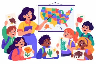
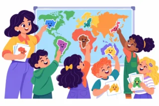
Students remember facts better when they know where those facts happen. Therefore, begin with the map. Show the United States first, then zoom in on the Mid-Atlantic region and New Jersey.
Ask students to describe the shape and its borders. New Jersey sits between New York and Pennsylvania, with Delaware to the southwest across Delaware Bay. The Delaware River forms much of the western border, the Hudson River lies along part of the northeast, and the Atlantic Ocean runs along the east coast. In other words, the state is surrounded by water on most sides.
Next, mark three anchor points on a blank outline map: Trenton, the capital, near the Delaware River; Newark in the northeast; and the shore along the Atlantic. These three points will hold many later New Jersey facts.
For example, Lila, a fictional third grader, traces the Delaware River with a blue crayon and labels Trenton with a star. Then, she adds a wavy line for the ocean. Now she has a mental picture before any reading begins.
In addition, give students a short “where is it” warm-up each day of the unit. Name a place, and students point to it on their own map. This two-minute habit keeps the geography fresh while new New Jersey facts pile up.
| Map feature | Where it is | Student task |
|---|---|---|
| Trenton | West, on the Delaware River | Draw a star |
| Atlantic Ocean | East coast | Draw waves |
| Hudson River | Part of the northeast | Trace in blue |
Also, point out how small the state is compared with its neighbors. That observation sets up a powerful idea later: a small state can hold a lot of people.
For students who need more support, provide a map with the borders already traced and three picture stickers to place. Meanwhile, students ready for more can add the Delaware Bay and one city they choose. Both groups end with the same core New Jersey facts on their maps.
2. Teach the state symbols with a reason
Symbols are the classic starting point for New Jersey facts in any state study. However, a list of symbols is easy to forget. Instead, pair each symbol with one short reason or picture so students can explain it in their own words.
Start with the nickname, the Garden State. Ask students what a garden state might grow, and connect the idea to farms and fresh produce. Then, introduce the state tree, the northern red oak, which grows tall and has strong wood. Add the state bird, the eastern goldfinch, a small yellow bird students can easily draw.
Next, look at the state flag together. Students can describe its colors and the pictures in the center, then compare it with their own state’s flag if they live elsewhere.
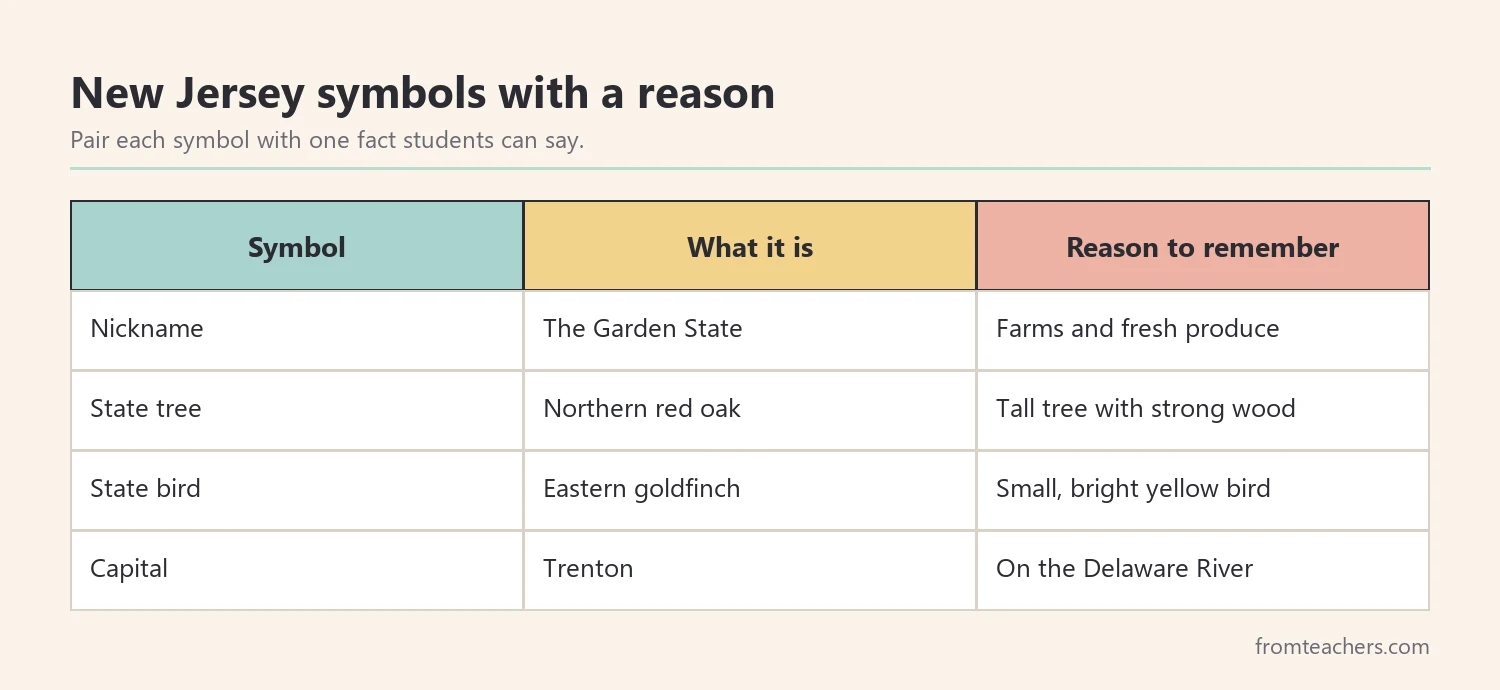
For instance, Lila draws the goldfinch on an index card and writes one sentence on the back: “The eastern goldfinch is the state bird, and it is bright yellow.” Card by card, she builds a small deck of New Jersey facts she can quiz a partner with.
A classroom slideshow can carry this step well. The New Jersey state study slideshow includes slides on the Garden State title, the state tree, and key symbols, so you can project each one while students make their cards.
Finally, keep the symbol list short. Four or five symbols with real understanding beat fifteen symbols that students only copy.
Moreover, invite students to vote on a symbol they would add if they could. This short discussion asks them to use what they know about the state to give a reason, which is real thinking rather than memorizing.
3. Explore the regions: Pine Barrens, shore, and cities
New Jersey changes a lot from one region to the next, and that contrast makes it a great state for compare-and-contrast thinking. Choose three regions and give each one a day or a center.
First, the Pine Barrens. This large forest in the southern part of the state covers about 1.1 million acres and is home to plants and animals that are rare in other places. Ask students why a forest that size matters in such a crowded state.
Second, the shore. The Atlantic coast has beaches, boardwalks, and lighthouses. Students can look at photos and list what people do there in summer and in winter.
Third, the cities. Newark, Jersey City, and Paterson are among the largest cities. Paterson is known for its waterfall, the Great Falls of the Passaic River. In addition, the state has more people per square mile than any other state, which surprises many students.
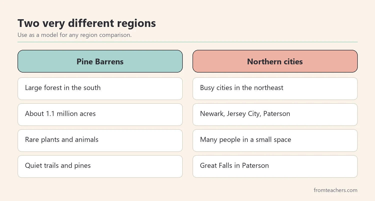
For example, Lila’s class of 24 students works in 6 groups of 4. Two groups study the Pine Barrens, two study the shore, and two study the cities. Each group shares three New Jersey facts with the class, so students hear 18 facts in one lesson.
Afterward, ask each student to choose the one region they would most like to visit and explain why in two sentences. Their answers show which New Jersey facts they understood and which ones need another look.
Also, connect the regions to the map from step 1. Students can color the Pine Barrens green, the shore blue, and the city area gray. As a result, their map grows into a summary of the whole unit.
4. Connect New Jersey facts to history and inventions
History-based New Jersey facts become clearer when students see events in order. Therefore, build one simple timeline with four or five events and let students add pictures.
Start with the American Revolution. In December 1776, George Washington crossed the Delaware River and won the Battle of Trenton. Then, in 1787, New Jersey became the third state to ratify the U.S. Constitution.
Next, move to inventions. Thomas Edison worked in a laboratory in Menlo Park, New Jersey, where he developed the phonograph in 1877. Later, he worked in West Orange. Students can talk about how a lab full of experiments earned Edison a famous nickname, “the Wizard of Menlo Park.”
After that, add a fun modern moment. The first drive-in movie theater opened in New Jersey in 1933. Students love imagining a movie on a giant outdoor screen while families watch from their cars.
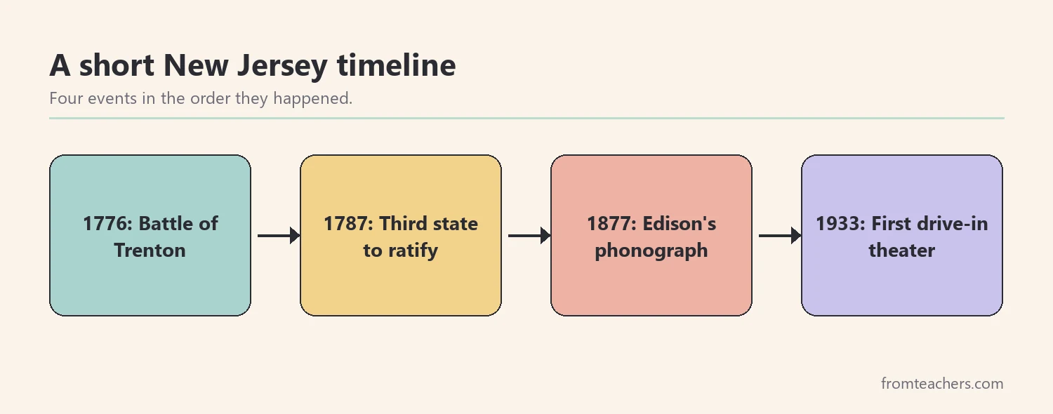
For example, Lila’s group builds a shoebox drive-in theater with a paper screen. On the screen, they draw the four timeline events in order. As a result, they practice sequencing while they talk about New Jersey facts.
Meanwhile, keep the history short and concrete for younger learners. A picture of a boat on an icy river or a lightbulb is enough to hold each event. Older students can add one sentence explaining why each event mattered.
Also, connect the economy to today. The state’s economy includes transportation, medicine, and technology. Ask students how busy ports and highways might connect to living between two large cities.
Finally, ask students to explain how one invention changed daily life. For example, a phonograph let people hear recorded sound at home for the first time. Discussions like this turn New Jersey facts into ideas students can reason about.
5. Wrap up New Jersey facts with a project and review
A short project lets students show which New Jersey facts they learned and can explain. Keep it small enough to finish in one or two sessions, and give a clear checklist so everyone knows what “done” looks like.
Good options include a one-page fact poster, a postcard from a New Jersey region, a mini book with one fact per page, or a short spoken report. Students who need more support can use sentence starters, picture choices, or a partner. In addition, students who finish early can add a “did you know” fact they found in a library book.
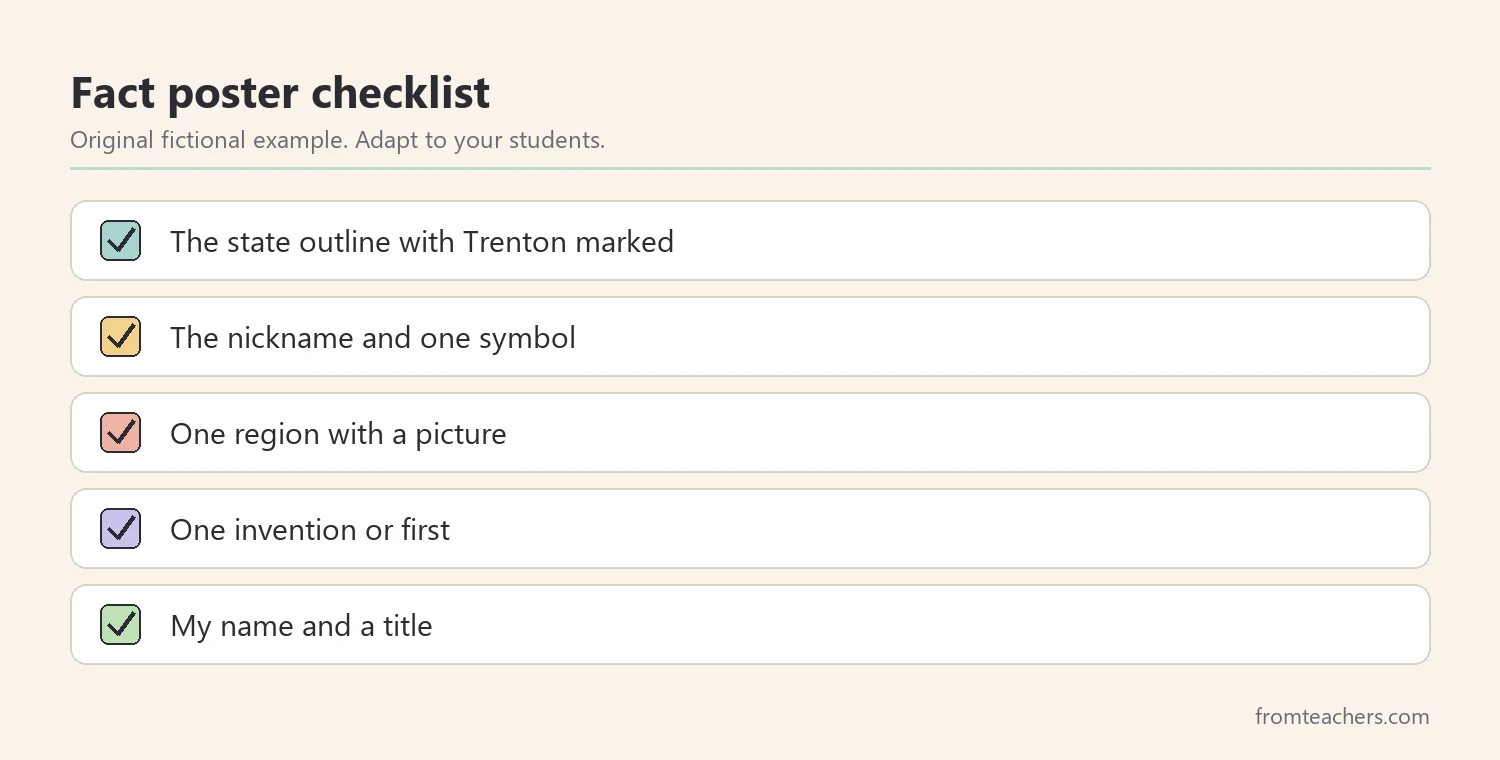
Then, close with a quick review game. For instance, read a clue such as “I am a large southern forest” and have students hold up the right picture card. Five or six clues are enough.
For example, Lila makes a postcard from the shore. On the front, she draws a lighthouse. On the back, she writes three New Jersey facts: the state nickname, the capital, and the drive-in theater from 1933. She checks each item on her list before she turns it in.
Finally, display the projects together. A wall of posters and postcards becomes a review tool for the whole class.
To check learning, ask each student three quick questions at the end: What is the capital? What is one region? What is one invention or first? These three New Jersey facts give you a simple, fair picture of what every student took away from the unit.
Common mistakes and how to avoid them
- Starting with a long fact list. Fix: begin with the map and three anchor points.
- Teaching symbols without meaning. Fix: pair each symbol with one short reason or picture.
- Treating the state as one place. Fix: compare regions so students see the variety.
- Listing dates out of order. Fix: build a short timeline and let students sequence it.
- Making the project too big. Fix: limit it to one page or a few items with a clear checklist.
Questions teachers and parents ask about New Jersey facts
What grade level is this state study best for?
Most elementary state studies happen in grades 2 to 5. Younger students can focus on the map, the nickname, and a few symbols. Older students can add history, regions, and short research.
How long should a New Jersey unit take?
About one week works for most classes, with one step per day. If you are studying several states, you can shorten it to two or three sessions by combining steps.
Which New Jersey facts surprise students most?
Students are often surprised that such a small state has more people per square mile than any other state. They also enjoy learning about the first drive-in theater and Edison’s inventions.
How can parents support a state study at home?
Look at a map together, read a short library book, or cook a simple dish with fresh tomatoes or blueberries, two crops linked to New Jersey farms. A few minutes of talk at dinner helps facts stick.
How do I support students who struggle with reading?
Use pictures, short sentences, and read-aloud slides. Let students show learning by pointing, drawing, or speaking. A partner can read while the student adds pictures.
Related reading: 5 Practical Teaching Tips to Boost Classroom Focus and Learning, Learning Styles Student Success Guide, and Homeschooling vs. Public Schooling.
A companion resource for New Jersey facts:
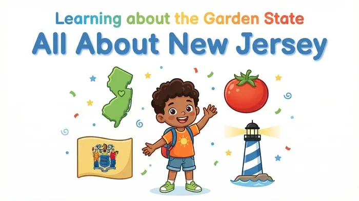
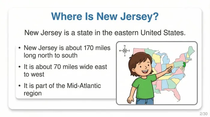
New Jersey State Study: Facts, Symbols, and Famous Landmarks: an “All About New Jersey” slideshow for elementary students with slides on the Garden State, major cities, the state tree, the Pine Barrens, the economy, the first drive-in theater, and a closing review.
Sources and scope
- State of New Jersey official website: general information about the state and its government.
- New Jersey Pinelands Commission: information about the Pine Barrens and their protection.
- National Park Service: park sites including the Thomas Edison National Historical Park in New Jersey.
- U.S. Census Bureau: population data for states and cities.
- National Council for the Social Studies: guidance for teaching social studies in the classroom.
This guide offers a simple elementary lesson sequence for a state study. It is not a complete history of New Jersey, and teachers should check current figures with official sources before students publish them.
Key takeaways
- Teaching New Jersey facts starts with the map and three anchor points.
- Symbols stick when each one has a short reason.
- Comparing the Pine Barrens, the shore, and the cities makes New Jersey facts more memorable.
- A short timeline links the Revolution, Edison, and the first drive-in.
- A small project with a checklist lets every student show what they learned.

Leave a Comment