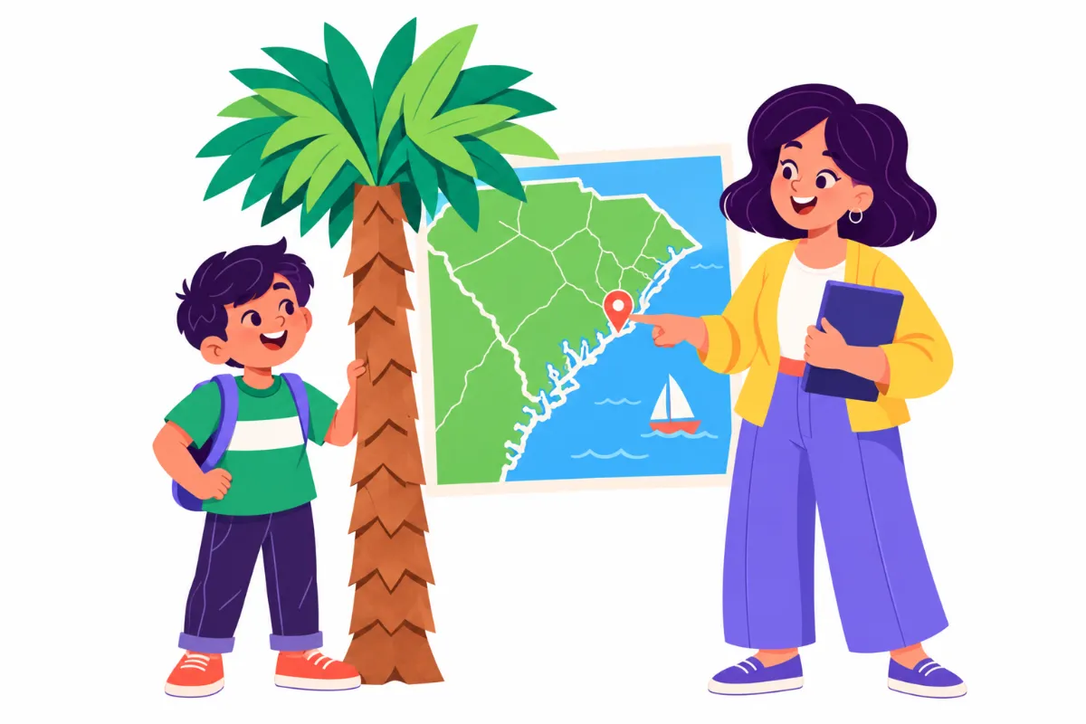

South Carolina facts can feel like a long list of names and dates until a student finds a reason to care. Picture a fourth grader staring at a blank state outline, unsure whether Charleston is on the coast or in the mountains, and quietly copying whatever the neighbor writes. The facts are there, but nothing connects them.
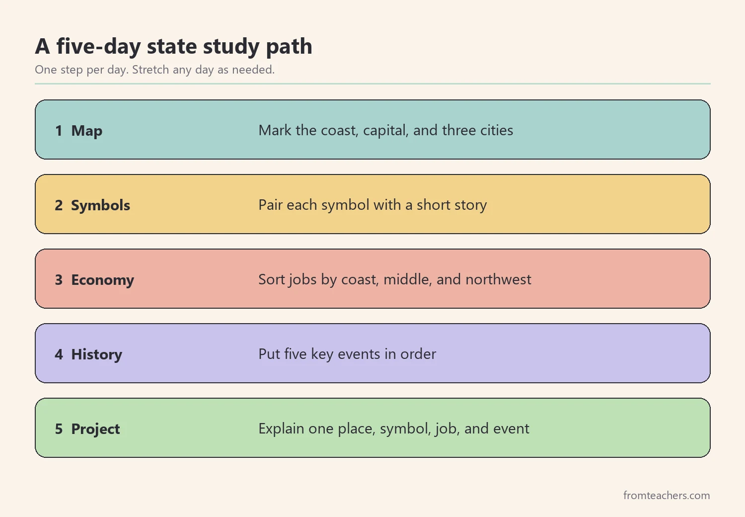
This guide turns a state study into a short, clear sequence you can teach in about a week. By the end, you will know how to introduce the state on a map, teach its symbols with stories, connect cities to the economy, build a simple history timeline, and close with a small project that shows what students really learned.
Examples are fictional. Adapt to the student’s goals and agreed supports. This is guidance, not a diagnosis.
At a glance
- Start every state study with the map, so each new fact has a place to live.
- Teach symbols through short stories, not a list to memorize.
- Link cities to jobs and trade so geography and economy make sense together.
- Put a few key events in order on a simple timeline.
- Finish with a small project that asks students to explain, not just recall.
1. Anchor South Carolina facts on the map first
First, give students a place to put every fact. A state study works best when the map comes before the list. When a student can point to the coast, the capital, and the mountains, later South Carolina facts have somewhere to land.
Start with the big picture. South Carolina sits in the southeastern United States, on the Atlantic coast. North Carolina lies to the north and Georgia lies to the southwest. Then, zoom in. Mark the capital, Columbia, near the middle of the state. Next, mark Charleston on the coast and Greenville in the northwest.
After that, show the land from the sea to the hills. The coast has beaches and marshes, the middle of the state is gentler, and the northwest corner reaches the Blue Ridge Mountains. Sassafras Mountain, in that corner, is the highest point in the state. Students do not need exact heights yet. They only need the idea that the land rises as you move inland.
Map checklist for the first lesson
- Outline of the state with the Atlantic Ocean labeled.
- Neighbor states: North Carolina and Georgia.
- Three dots: Columbia, Charleston, Greenville.
- A simple key for coast, middle, and mountains.
- A compass rose so students can say “northwest” with confidence.
Worked example. Maya is a fictional student in grade 4 who finds long fact lists hard to remember. On day one, her teacher gives her a blank outline and three colored dot stickers. Maya places Columbia in the middle, Charleston on the coast, and Greenville near the top left. She then shades a thin strip along the ocean for the coast. When her teacher asks, “Where would you go to see the ocean?”, Maya points straight to Charleston.
In short, the map becomes the frame for the rest of the week. Every new fact gets pinned to a place.
2. Teach South Carolina facts about symbols through stories
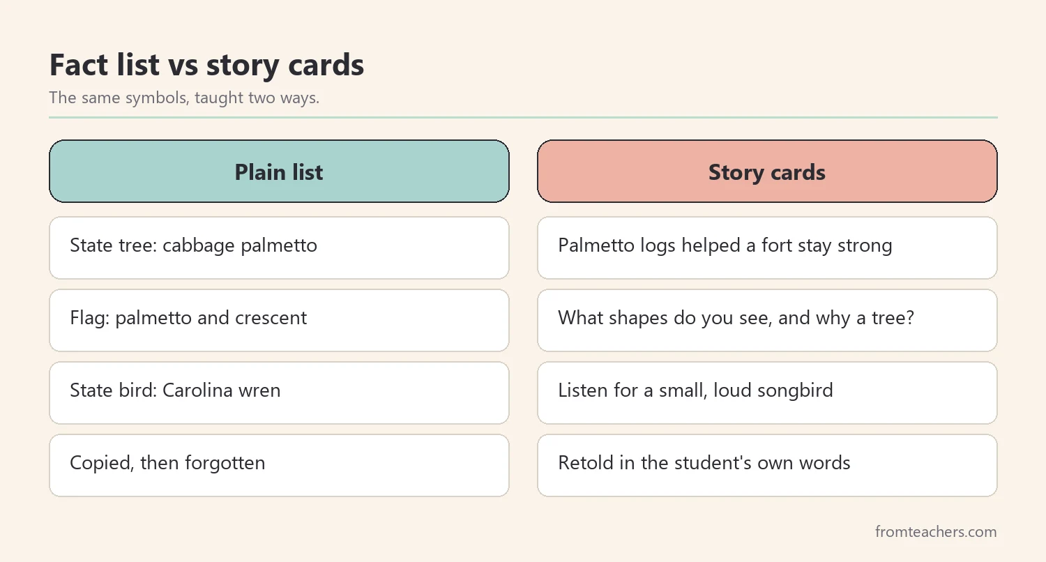
Next, move from places to symbols. Symbol South Carolina facts are easy to list, but stories make them stick. So, pair each symbol with one short story or question that students can retell.
The state is known as the Palmetto State, and the palmetto tree is its state tree. The cabbage palmetto grows along the coast, and it can reach up to about 65 feet tall. In addition, the palmetto appears on the state flag next to a crescent shape on a blue background. Ask students what shapes they see on the flag, then ask why a tree might be chosen for a flag.
Then, tell the palmetto fort story. During the American Revolution, defenders on Sullivan’s Island near Charleston built a fort from palmetto logs. The spongy wood helped the fort hold up against cannon fire, and the palmetto became a symbol of strength. Today, that site is known as Fort Moultrie. A quick hands-on test helps here: drop a small ball onto a sponge and onto a thin cracker, then compare.
| Symbol | Fact | Story or question |
|---|---|---|
| Nickname | The Palmetto State | Why name a state after a tree? |
| State tree | Cabbage palmetto | The spongy fort logs |
| Flag | Palmetto and crescent on blue | What shapes do you see? |
| State bird | Carolina wren | Listen for a small, loud songbird |
Worked example. Maya makes three symbol cards: tree, flag, and bird. On the back of each card, she writes one sentence in her own words. For the tree card she writes, “Palmetto logs helped a fort stay strong.” Because the card has a story, she remembers it the next day without looking.
As a result, these South Carolina facts become stories students can tell, not words they copy.
3. Connect cities to the economy with South Carolina facts
Once students know the map and the symbols, connect places to what people do there. This step turns geography into something students can reason about. Why would a port grow on the coast? Why would factories need roads and rail?
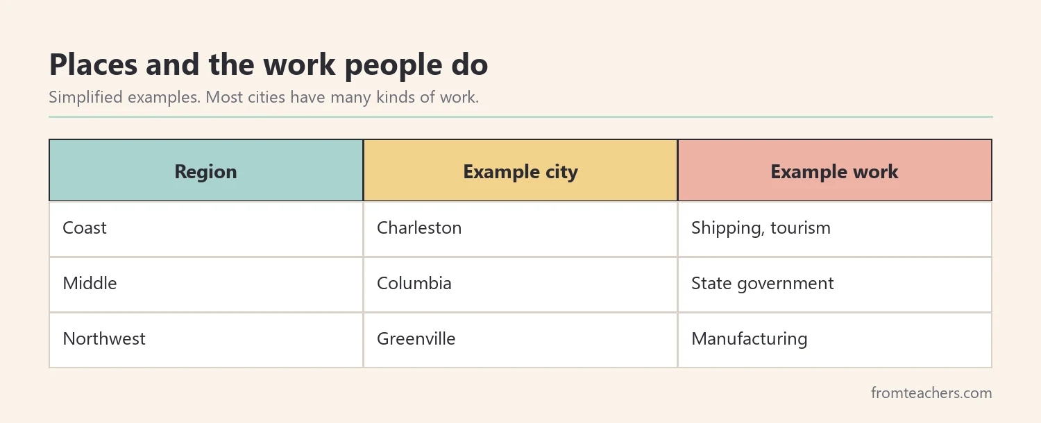
Start with the coast. Charleston is a historic coastal city with a busy seaport, and North Charleston sits right next to it. Ships carry goods in and out, so shipping and trade matter to the state. Then, move inland to Greenville, a growing city in the northwest. Manufacturing is an important part of the state economy, and tourism brings visitors to the beaches and historic sites.
Next, ask students to sort South Carolina facts about jobs by place. A simple three-column chart works well: coast, middle, and northwest. For example, a ship worker goes on the coast, a state government worker fits Columbia, and a factory worker could fit several places. The sorting matters less than the reason students give.
If you want a ready-made visual introduction, the All About South Carolina slideshow includes slides on major cities, the state tree, the economy, and a fun fact about the counties, so you can show it on the board before students sort.
Worked example. Maya sorts six job cards. She places two on the coast (ship worker, tour guide), one in Columbia (state lawmaker), and three that could fit more than one place (factory worker, farmer, teacher). That makes six cards in all. When asked why the ship worker belongs on the coast, she says, “Because the ships need the ocean.” That one sentence shows she connected place and work.
In other words, the economy is not a separate topic. It grows out of the map students already built.
4. Put South Carolina facts from history in order
History becomes clearer when students see events in order. Keep the timeline of South Carolina facts short. Four or five well-chosen events are better than twenty dates nobody remembers.
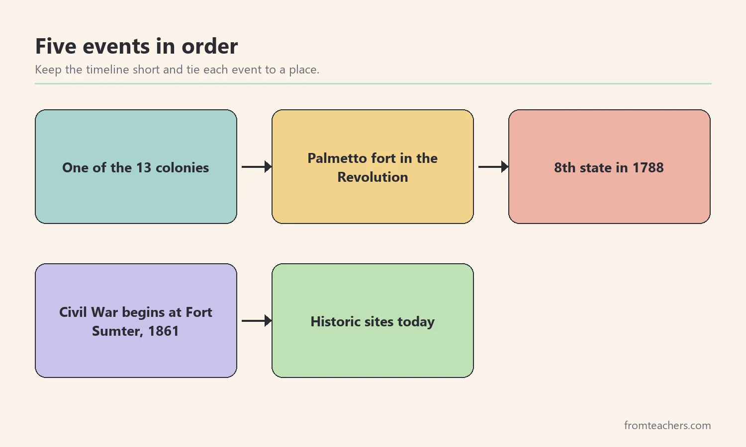
Begin with the colony years. South Carolina was one of the original thirteen colonies. Then, add the American Revolution and the palmetto fort story from step 2, so students see the link. After that, add 1788, when South Carolina approved the U.S. Constitution and became the eighth state. Next, add 1861, when the Civil War began with the attack on Fort Sumter in Charleston Harbor. Finally, add today: Fort Sumter is now a national historical park that visitors can explore.
Also, talk about the people behind the dates in an age-appropriate way. The state’s history includes enslaved people whose labor and lives shaped the colony and the state. Naming this honestly helps students understand why the Civil War happened and why historic sites matter.
| Order | Event | Link to earlier steps |
|---|---|---|
| 1 | One of the 13 colonies | Coast and ports |
| 2 | Palmetto fort in the Revolution | State tree story |
| 3 | Becomes the 8th state in 1788 | Capital and government |
| 4 | Civil War begins at Fort Sumter, 1861 | Charleston Harbor on the map |
| 5 | Historic sites today | Tourism and the economy |
Worked example. Maya receives five event strips in mixed order. She lines them up from oldest to newest, then draws an arrow from the Fort Sumter strip to Charleston on her map. When she explains her timeline, she uses the word “then” between each event. Her teacher notices that she now links history to places without being asked.
Therefore, the timeline is not a new pile of South Carolina facts. It ties together what students already know.
5. Close with a small project on South Carolina facts
Finally, ask students to show what they understand. A small project works better than a long test for most elementary learners. It also gives students who struggle with writing other ways to show their thinking.
Offer a few formats with the same goal. For example, students might create a one-page travel poster, a three-slide mini presentation, or a fact flap book. Each project should include one place, one symbol, one job, and one event, explained in the student’s own words. That gives four parts in every project, no matter the format.
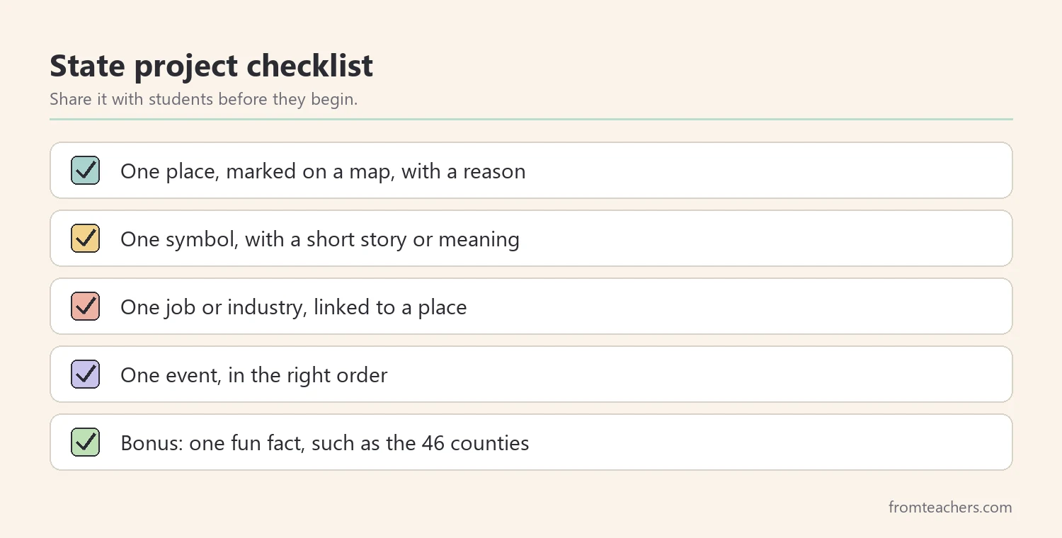
Then, keep the scoring simple and visible. Students should know before they begin what a strong project includes. A four-row checklist is enough for most classes.
Project checklist
- One place, marked on a map, with a reason it matters.
- One symbol, with a short story or meaning.
- One job or industry, linked to a place.
- One event, placed in the right order with a date or era.
Also, add a fun fact as a bonus. South Carolina has 46 counties, and students often enjoy finding their favorite county name. Bonus facts should never replace the four required parts, however.
Worked example. Maya chooses a travel poster. She draws Charleston on a small map, adds a palmetto with the fort story, labels a ship for the port, and writes “1861: Fort Sumter” in a corner box. Her poster meets all four checklist rows. When she presents, she explains each part in one or two sentences and answers a classmate’s question about the flag.
In the end, these South Carolina facts belong to Maya. She can explain them, not just repeat them.
Common mistakes and how to avoid them
- Starting with a long fact list. Students copy without understanding. Fix: start with the map and add South Carolina facts one place at a time.
- Teaching symbols as vocabulary only. Names fade fast. Fix: pair each symbol with a short story or question.
- Treating the economy as a separate unit. It feels abstract. Fix: connect jobs to places students already marked.
- Too many dates. Students mix them up. Fix: keep four or five events and tie each one to a place.
- Grading only spelling and neatness. It hides real understanding. Fix: score place, symbol, job, and event first.
- Using numbers you have not checked. City populations change over time. Fix: say “about” and check a current official source before sharing figures.
Questions teachers and parents ask about South Carolina facts
How many South Carolina facts should a fourth grader learn?
Aim for a small, connected set rather than a long list. One place, one symbol, one job, and one event per student is a strong goal. Students who are ready can add more.
How long should a state study take?
Many teachers use about one week, with one step per day. However, you can stretch it to two weeks if students research more deeply. The order of the steps matters more than the length.
How do I support students who find reading hard?
Use visuals, maps, and short story cards for South Carolina facts. Read text aloud and let students show learning by drawing, sorting, or speaking. The goal is understanding the state, not reading speed.
Can parents use these South Carolina facts at home?
Yes. A blank map, a few symbol cards, and a short timeline work well at a kitchen table. In addition, a family trip to a historic site or museum can turn a fact into a memory.
How should I teach the Civil War part with young children?
Keep it honest and age-appropriate. Explain that the war was fought over slavery and the future of the country, and that Fort Sumter is where it began. Then, focus on how historic sites help us remember and learn.
Related reading: Learning Styles Student Success Guide, 5 Practical Teaching Tips to Boost Classroom Focus and Learning, and Homeschooling vs. Public Schooling: Which Educational Path Is Right for Your Child?
A companion resource for teaching South Carolina facts:
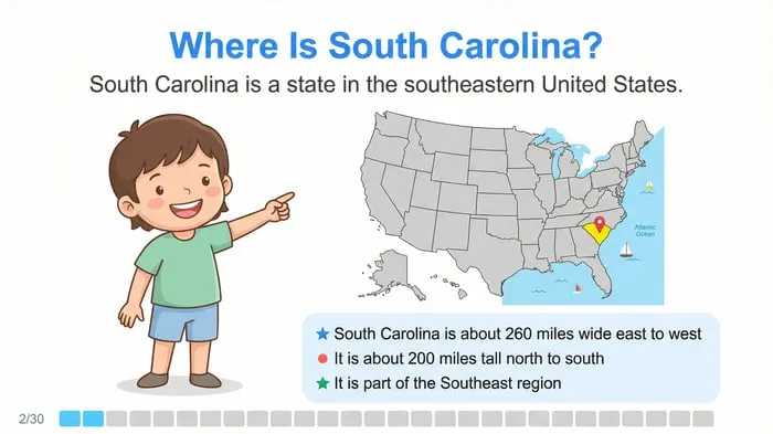
South Carolina State Study: Facts, Symbols, and Famous Landmarks: an “All About South Carolina” slideshow for elementary students with a title slide, major cities, the state tree, the state economy, a fun fact about the 46 counties, and a closing review of key symbols and landmarks.
Sources and scope
- Fort Sumter and Fort Moultrie National Historical Park, National Park Service: official information about the two forts and their history.
- South Carolina Department of Archives and History: the state agency that preserves public records and historic places.
- Library of Congress: primary sources, maps, and teaching materials on American history.
- National Council for the Social Studies: guidance and resources for social studies teaching.
- U.S. Census Bureau: current population figures for states and cities.
This guide covers a short elementary state study with core facts, symbols, places, and events. It does not replace your state standards or a full history curriculum, so check current figures and local requirements before teaching.
Key takeaways
- Teach South Carolina facts on the map first so every fact has a place.
- Use short stories, like the palmetto fort, to make South Carolina facts about symbols memorable.
- Connect cities to jobs, ports, and trade.
- Keep the history timeline to a few events tied to places.
- Close with a small project that asks students to explain what they learned.







Leave a Comment