

New Hampshire facts can feel like a long list of names and dates to a young learner, and that list fades fast. Picture a third grade class on a gray Monday: the map is up, the slideshow is ready, and five minutes later half the room cannot remember whether Concord is a city or a lake.
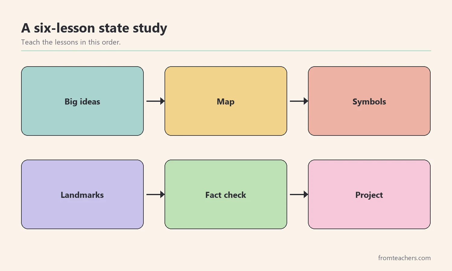
This guide turns that list into a short unit with a clear shape. After reading, you will be able to plan a six-step state study, connect each fact to a picture or story, check that students can explain what they learned, and wrap up with a small project that shows real understanding.
Examples are fictional. Adapt to the student’s goals and agreed supports. This is guidance, not a diagnosis.
At a glance
- Start with three big ideas, not thirty details.
- Anchor every fact to the map before you add symbols.
- Give each symbol a memory hook: a picture, an action, or a short story.
- Teach students to check a fact against a trusted source.
- End with a small project that asks students to explain, not just recall.
1. Choose the big ideas for your New Hampshire facts unit
First, decide what students should still know a month from now. A state study works best when every lesson hangs on a few big ideas. For New Hampshire, three ideas cover most of what elementary students need.
- Place: New Hampshire is a small state in New England, with mountains in the north, lakes in the middle, and a short ocean coast in the southeast.
- Identity: its nickname is the Granite State, and its motto is “Live Free or Die.”
- History: it was one of the thirteen original colonies, and it is famous today for holding an early presidential primary.
Next, write these ideas on a chart and keep it on the wall for the whole unit. When a new fact appears, ask the class which big idea it belongs to. As a result, facts stop floating around on their own and start to form groups.
For example, Ms. Lane plans a two-week unit for her third grade class. One of her students, Maya, loves drawing but struggles to remember names. Ms. Lane decides that Maya will keep a “fact folder” with one drawing for each big idea. By the end of week one, Maya has three drawings: a mountain, a granite rock with the nickname, and a colonial flag.
| Big idea | Sample fact | Quick check question |
|---|---|---|
| Place | Lake Winnipesaukee is the largest lake | Point to the lakes region. |
| Identity | Nickname: the Granite State | Why granite? |
| History | One of the 13 original colonies | What is a colony? |
Finally, keep the list of required facts short. Ten to twelve core facts are plenty for a young class. You can always add extension facts for fast finishers.
2. Build the map before the details
Because every fact happens somewhere, the map comes first. Students remember a lake better when they can point to it. They also remember a city better when they know which way to travel to reach it.
Start with the outline of the state. Then ask students to find its neighbors: Maine to the east, Vermont to the west, Massachusetts to the south, and Canada to the north. After that, add three regions in simple words: the White Mountains in the north, the Lakes Region in the middle, and the Seacoast in the southeast.
Next, add a few key places. Concord is the capital. Manchester is the largest city, and Nashua sits near the southern border. Portsmouth is the historic port city on the coast. The Merrimack River runs south through the state, past Concord and Manchester.
In Maya’s class, each student gets a blank outline and four colored pencils. Ms. Lane calls out one place at a time, and students mark it with a symbol they choose. Maya draws a tiny boat for Portsmouth and a star for Concord. Later, she uses the same symbols in her project, which saves her time and keeps her map consistent.
Also, keep a large class map on the wall. When a new fact comes up later in the unit, a student pins a sticky note on the right spot. By the last day, the wall map becomes a visual summary of the whole unit.
Map tips for mixed-ability groups
- Give some students a map with the regions already shaded.
- Use a word bank with the four neighbor names.
- Let students point and say the name instead of writing it.
- Pair a strong map reader with a student who needs a model.
3. Teach symbols with a memory hook
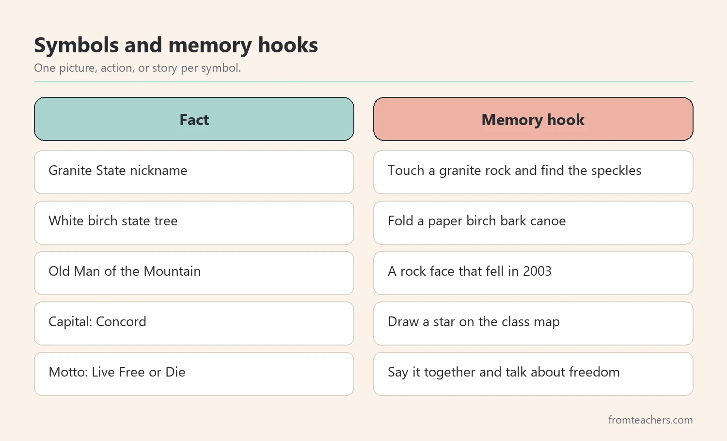
State symbols are where many New Hampshire facts get lost. However, a symbol is easy to remember when it comes with a picture, an action, or a short story. The goal is one hook per symbol, not a paragraph.
For instance, the state tree is the white birch, sometimes called the paper birch. Its bark is white and peels in thin sheets. Show a photo, then tell students that people have used birch bark to make canoes. Some classes fold a paper canoe to make the hook stick.
Similarly, the nickname “Granite State” comes from the granite rock found across the state. Pass around a piece of granite if you have one, or show a close-up photo. Ask students to describe the speckles they see. A tactile moment like this often does more than a written definition.
Another strong hook is the Old Man of the Mountain. It was a rock formation in the White Mountains that looked like a face in profile. It collapsed in 2003, but it still appears on the state quarter and remains a well-known symbol. Students are often surprised that a symbol can disappear, which leads to a good discussion about why people keep it.
If you want ready-made visuals for this step, the New Hampshire state study slideshow includes slides on major cities, lakes and rivers, the state tree, and the Old Man of the Mountain. You can show one slide per hook and pause for discussion.
4. Explore landmarks, weather, and the economy
Once students know the map and the symbols, they are ready for stories about real places. This is where curiosity grows. Pick two or three landmarks and spend time on each one instead of listing ten.
Mount Washington is a great choice. It is the highest peak in the northeastern United States, at 6,288 feet. It is also famous for extreme weather. In 1934, observers on the summit recorded a wind gust of 231 miles per hour. Ask students to compare that number with the speed of a car on the highway. That simple comparison makes the fact real.
Next, visit Lake Winnipesaukee, the largest lake in the state. Show its long, irregular shoreline on the map, and ask students why so many people visit lakes in summer. Then connect that answer to the economy. Tourism and outdoor recreation, such as hiking, skiing, and boating, matter to New Hampshire. Manufacturing and technology are important too.
For example, Maya’s group studies Mount Washington. They make a “weather card” with three facts: its height, its 1934 wind gust, and its snowy winters. Then they present the card to the class in under two minutes. Because each group studies one landmark, the class learns three landmarks without three long lectures.
Questions that build curiosity
- Why might mountains have stronger winds than valleys?
- How could a lake help a town earn money?
- What would you pack for a hike in the White Mountains?
5. Check New Hampshire facts like a researcher
Kids find facts everywhere: books, videos, websites, and friends. Some of those facts are wrong or out of date. Therefore, this step teaches a simple routine students can use for any state study.
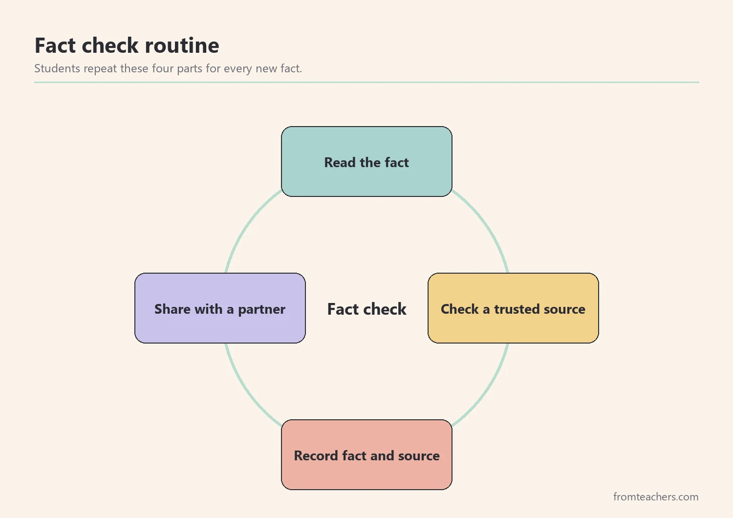
First, students read or hear a fact. Second, they check it in a trusted source, such as the official state website or a library book. Third, they record the fact with the source name. Finally, they share it with a partner, who asks one question about it. This routine is quick, and it builds good research habits early.
To practice, give students a sort of eight statements. Some are true, and some are false. For example, “The capital of New Hampshire is Manchester” is false, because the capital is Concord. “The state tree is the white birch” is true. Students sort the cards into two piles, then fix every false statement.
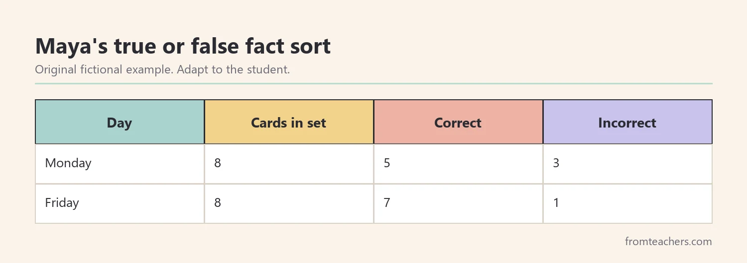
In Maya’s class, students sort the same eight cards on Monday and again on Friday. Figure 4 shows Maya’s results. On Monday she sorts 5 cards correctly and 3 incorrectly. On Friday she sorts 7 correctly and 1 incorrectly. Each row adds up to the 8 cards in the set, so the change is easy to see.
Also, notice which facts students miss. If many students confuse the capital and the largest city, reteach that pair with the map. As a result, your review time goes where it is needed.
6. Wrap up with a project that shows understanding
The final step asks students to explain what they know. A small project works better than a long test for most young learners. It also gives students who struggle with writing a fair way to show their thinking.
Keep the project simple. Each student makes a one-page “state postcard” or a short poster. It should include the state shape, the capital, one symbol with its hook, one landmark, and one fact the student checked with a source. Students can draw, write, or dictate their sentences.
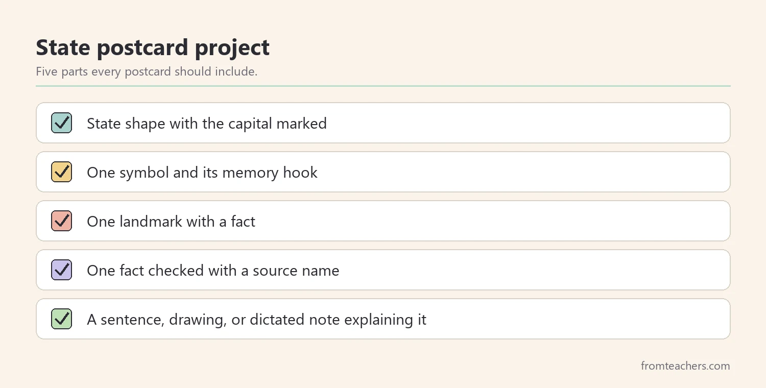
Maya chooses the postcard. She draws the state with her star for Concord, adds a birch tree with a tiny canoe, and writes one sentence about the 1934 wind gust. Then she adds “Source: library book” under her checked fact. During sharing time, she explains why granite gave the state its nickname. Her explanation shows she understands the fact, not just the word.
Finally, display the projects next to the class map. Students enjoy seeing their work beside the facts they pinned earlier. Families also get a clear picture of what the class learned.
Common mistakes and how to avoid them
- Teaching too many facts at once. Fix: limit the core list to about ten facts and offer extras as challenges.
- Starting with symbols before the map. Fix: build the map first so every fact has a place.
- Listing landmarks without stories. Fix: pick two or three landmarks and give each one a vivid comparison.
- Accepting any fact from the internet. Fix: teach the read, check, record, and share routine early.
- Testing only with written recall. Fix: let students show learning through drawing, speaking, or a short project.
Questions teachers and parents ask about New Hampshire facts
How many New Hampshire facts should young students learn?
About ten core facts work well for grades 2 to 4. Choose facts that connect to the big ideas of place, identity, and history. Then add extra facts for students who want more.
What is the best first fact to teach?
Start with where the state is and who its neighbors are. Location gives every later fact a home. After that, the capital and the nickname are natural next steps.
How can parents support a state study at home?
Parents can look at a map together, read a library book about the state, or cook a simple recipe tied to a region. Short talks at dinner also help. Asking “what was the most surprising fact today?” invites a child to explain.
How do I adapt the unit for students who struggle with reading?
Use pictures, short labels, and spoken answers. Pair students for map work, and offer a word bank during the project. Also, let students dictate sentences if writing slows them down.
Can this plan work for other states?
Yes. The six steps fit any state: big ideas, map, symbols, landmarks, fact checking, and a project. Only the facts change. Many teachers reuse the same routine across a whole 50 states unit.
Related reading: 5 Practical Teaching Tips to Boost Classroom Focus and Learning, Learning Styles Student Success Guide, and Homeschooling vs. Public Schooling: Which Educational Path Is Right for Your Child?
A companion resource for teaching New Hampshire facts:
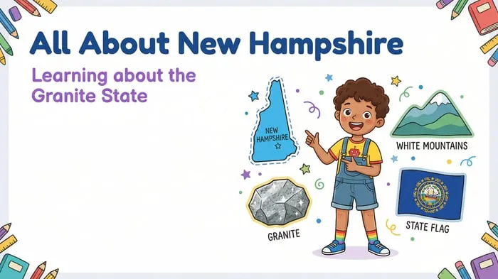
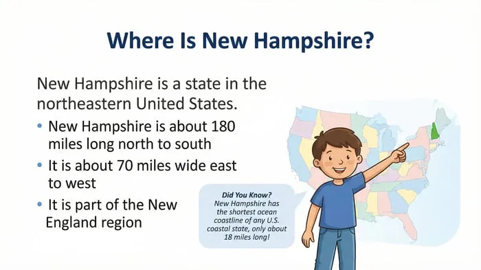
New Hampshire State Study: Facts, Symbols, and Famous Landmarks: an illustrated “All About New Hampshire” slideshow for elementary students, with slides on major cities, lakes and rivers, the economy, the white birch, the Old Man of the Mountain, and a closing review of key symbols and landmarks.
Sources and scope
- NH.gov: the official website of the State of New Hampshire, a good place to confirm basic state information.
- Mount Washington Observatory: a nonprofit weather observatory on the summit, with information about the mountain’s weather history.
- Library of Congress: primary sources, maps, and photographs useful for state and U.S. history lessons.
- National Council for the Social Studies: a professional organization with guidance for social studies teaching.
This guide covers planning and teaching an elementary state study of New Hampshire. It does not replace your state or district standards, and facts should be checked against current official sources before teaching.
Key takeaways
- Organize the unit around three big ideas: place, identity, and history.
- Teach the map first so every fact has a location.
- Give each symbol one simple memory hook.
- Build a habit of checking facts against trusted sources.
- Finish with a short project that lets students explain their learning.






Leave a Comment