

South Dakota facts come alive for kids when each one connects to something they can picture: four giant faces carved in granite, bison grazing on open grassland, and strange striped rock towers in the Badlands. Picture a fourth grade class starting a state study. The teacher reads a list of ten facts, and by lunch, the students remember only “Mount Rushmore.” The rest slipped away because nothing anchored them.
This guide gives you a five-step unit plan. You will place South Dakota on the map, teach a few core facts, explore its famous places, connect symbols and daily life, and finish with a review that shows what students really learned. Each step follows the same fictional class, with simple activities for mixed-ability groups.
Examples are fictional. Adapt to the student’s goals and agreed supports. This is guidance, not a diagnosis.
At a glance
- Start with the map: six neighbors and the Missouri River running through the middle.
- Teach a small set of core facts first: capital, nickname, statehood, and largest city.
- Use famous places, like Mount Rushmore and the Badlands, as memory anchors.
- Connect symbols and the economy to the land students have already mapped.
- Review with a short quiz plus a creative project.
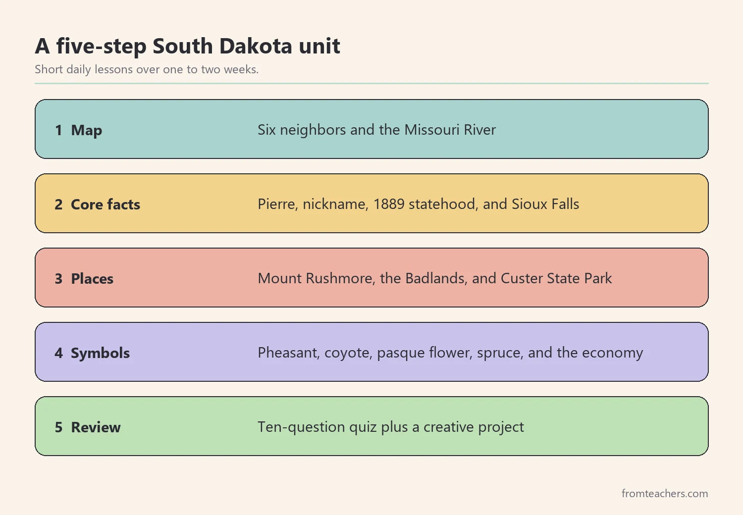
1. Map South Dakota facts before anything else
First, give students a mental map. South Dakota sits in the northern part of the Great Plains, in the middle of the country. Ask students to find it on a United States map, then trace its borders with a finger.
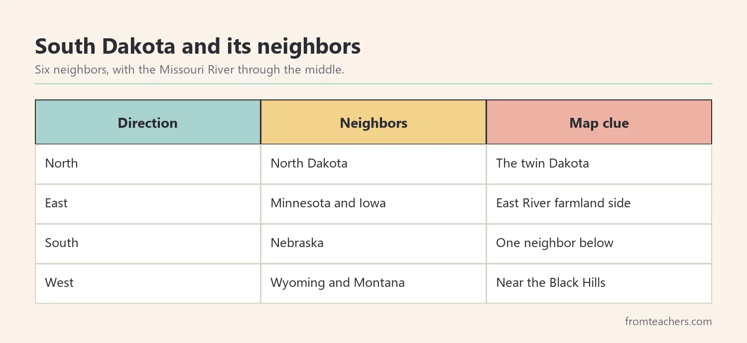
Next, name the six neighbors. North Dakota is to the north. Minnesota and Iowa are to the east. Nebraska is to the south. Wyoming and Montana are to the west. Six neighbors is a lot, so use a simple chant or a compass rose to help students remember.
| Direction | Neighbors |
|---|---|
| North | North Dakota |
| East | Minnesota and Iowa |
| South | Nebraska |
| West | Wyoming and Montana |
Then add the Missouri River. It flows through the middle of the state from north to south. South Dakotans often talk about “East River” and “West River” to describe the two sides. East of the river is mostly farmland. West of the river are ranches, the Badlands, and the Black Hills.
For example, in Mr. Lee’s fictional fourth grade class, students color a blank outline of South Dakota, draw the Missouri River in blue, and label the neighbors. One student, Ava, has fine motor difficulties, so she uses label stickers and a thick marker for the river. Everyone ends with the same finished map.
Finally, hang a large class map on the wall. As the unit continues, students add pictures for each new fact. By the end, the map becomes a visual summary of all your South Dakota facts.
For home learners, the same map works well on a kitchen table or a fridge door. Add one sticker a day as the family learns new South Dakota facts, and the map quietly becomes a review tool every time someone walks past.
2. Teach the core South Dakota facts
Before landmarks, lock in a small set of core facts. Young learners remember four or five facts learned well far better than twenty facts heard once.
Start with the capital. Pierre is the capital of South Dakota. It sits near the center of the state, on the Missouri River. Point out that it is pronounced “peer,” which students usually find surprising and therefore remember.
Next, teach the nickname. South Dakota is called “The Mount Rushmore State.” This nickname is a helpful bridge to step 3, where students learn about the monument itself.
Then add statehood. South Dakota became a state on November 2, 1889, the same day as North Dakota. Students enjoy the idea of “twin” states that share a birthday.
| Core fact | Picture clue |
|---|---|
| Capital: Pierre | A star on the river |
| Nickname: The Mount Rushmore State | Four small faces |
| Statehood: 1889 | Two birthday cakes, for the twin Dakotas |
| Largest city: Sioux Falls | A waterfall |
Also, introduce the main cities. Sioux Falls is the largest city, in the southeast corner. Rapid City is the main city in the west, near the Black Hills. Aberdeen is a regional city in the northeast.
In Mr. Lee’s class, students make a four-square fact card with one picture clue per square. Then the class plays a quick game at the start of each lesson: the teacher shows a picture, and students call out the fact. These quick reviews help South Dakota facts move into long-term memory.
In addition, a ready-made slideshow can carry much of this teaching. The South Dakota state study slideshow introduces the Mount Rushmore State, its major cities, the state tree, the economy, and fun facts one slide at a time.
Before moving on, check that the core facts are solid. Ask each student to tell a partner the capital, the nickname, and two neighbors. If most can, continue. If not, spend one more short session on the picture clue game before adding new South Dakota facts.
3. Anchor South Dakota facts in famous places
Famous places turn a list of facts into pictures students can hold on to. South Dakota has several landmarks that children find exciting.
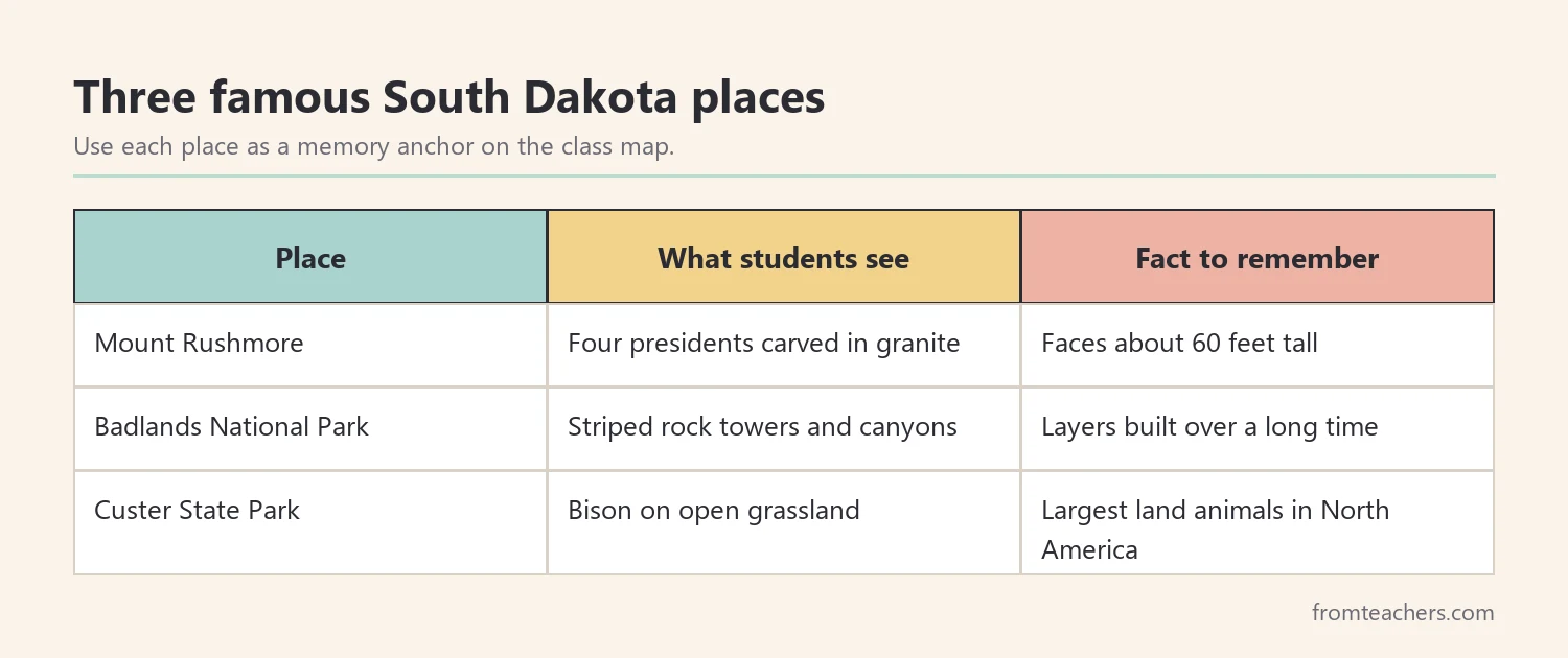
Start with Mount Rushmore National Memorial in the Black Hills. It shows the faces of four presidents carved into granite: George Washington, Thomas Jefferson, Theodore Roosevelt, and Abraham Lincoln. Carving took place between 1927 and 1941. Each face is about 60 feet tall, roughly as tall as a six-story building.
Next, visit the Badlands. Badlands National Park has layered rock formations, deep canyons, and grassy prairie. The stripes in the rock come from layers built up over a very long time. Students love drawing these colorful, striped shapes.
Then introduce Custer State Park, also in the Black Hills, which is home to a large herd of bison. Bison are the largest land animals in North America, and seeing them in photos helps students connect South Dakota with the wide-open plains.
For a hands-on activity, set up three stations, one per place. At each station, students look at photos, read a short card, and write or draw one fact. Groups rotate every five minutes. In Mr. Lee’s class, Ava’s group records their facts on a tablet, and Ava shares them aloud.
Finally, add each place to the class map. Students place Mount Rushmore and Custer State Park in the Black Hills and the Badlands to the east of them. Now their South Dakota facts are not only memorized but also placed in real locations.
Meanwhile, invite curiosity. Students often ask how the faces on Mount Rushmore were carved or why the Badlands look striped. Write these questions on a “Wonder Wall” and let early finishers research one. Questions like these turn South Dakota facts into real inquiry.
4. Connect symbols and daily life to the land
Next, link the state’s symbols and economy to the land students have mapped. This turns separate facts into a connected picture.
Start with symbols. The state bird is the ring-necked pheasant. Its state animal is the coyote. The state flower is the pasque flower, an early spring bloom on the prairie. In addition, the state tree is the Black Hills spruce, which grows in the Black Hills region.
| Symbol | What it is | Where to draw it |
|---|---|---|
| Ring-necked pheasant | State bird | East River farmland |
| Coyote | State animal | West River plains |
| Pasque flower | State flower | Prairie areas |
| Black Hills spruce | State tree | Black Hills |
Then talk about how people earn a living. Farming and ranching are important, with crops like corn and soybeans and herds of cattle. Tourism matters too, because millions of visitors come to see Mount Rushmore and the Black Hills each year. Manufacturing also plays a role.
In Mr. Lee’s class, students sort picture cards into three baskets: farming, tourism, and manufacturing. Then they place each card on the map where it fits best. Sorting turns South Dakota facts into a short thinking task instead of a memory drill.
Also, share one fun fact. South Dakota has 66 counties, ranging from flat plains to forested hills. Students can guess the number before you reveal it, which adds a little suspense.
In addition, compare East River and West River. Ask students to list what they would see on each side: farms and pheasants in the east, ranches, hills, and bison in the west. This simple comparison helps students organize South Dakota facts by region instead of memorizing them one at a time.
5. Review South Dakota facts with a quiz and a project
Finally, give students a chance to show what they know. A short quiz shows who has the core facts, and a creative project lets students go further.
Keep the quiz to ten questions. Mix formats: labeling neighbors, matching symbols to pictures, and choosing the capital from three options. For students who find writing hard, read questions aloud or allow pointing answers.

In this example, 15 students scored 9 or 10, 7 students scored 7 or 8, and 3 students scored 6 or below. That adds up to 25 students. So Mr. Lee plans a quick whole-class review game and a short small-group reteach with picture clue cards for the three students who need it.
Next, finish with a creative project. Students can design a postcard from Mount Rushmore, build a clay model of the Badlands, or write a short travel guide. Projects let students show understanding in different ways, which is especially helpful for learners with IEPs.
Lastly, walk the class map together. Ask students to point to each picture and name the fact. This five-minute review ties every piece of your South Dakota facts unit together.
Finally, ask students which South Dakota place they would most like to visit and why. Their answers show which facts made the strongest impression, and they make a natural bridge to the next state in your study.
Common mistakes and how to avoid them
- Teaching only Mount Rushmore. Students miss the bigger picture. Fix: add the Badlands, bison, and the Missouri River.
- Skipping the map. Facts feel random. Fix: build a class map and add a picture for each fact.
- Rushing through six neighbors. Students mix them up. Fix: teach them by direction with a compass rose.
- Using long lists of numbers. Dates and figures blur together. Fix: pick one or two numbers that tell a story.
- Testing only through writing. Some students know more than they can write. Fix: allow pointing, oral answers, or projects.
Questions teachers and parents ask about South Dakota facts
What South Dakota facts should every student know?
Start with the capital, Pierre, the nickname “The Mount Rushmore State,” the largest city, Sioux Falls, and the neighboring states. Add Mount Rushmore and the Badlands as key places.
What grade level is best for South Dakota facts?
Most state studies happen in grades 2 to 5. Younger students focus on the map and symbols. Older students can add history, the economy, and research projects.
How long should a South Dakota unit last?
A focused unit can run one to two weeks with short daily lessons. In a 50-states unit, a few days per state is common. Adjust to your students and schedule.
How do I support students who struggle with reading?
Use photos, picture clues, and read-alouds. Let students answer by pointing or speaking. Partner work and word banks also help everyone take part.
Can parents teach South Dakota facts at home?
Yes. A printed map, a few photos, and a short daily game are enough. Families can also look at pictures of Mount Rushmore and bison together.
Related reading: Learning Styles and Student Success Guide, 5 Practical Teaching Tips to Boost Classroom Focus and Learning, and Homeschooling vs Public Schooling.
A companion resource for South Dakota facts:
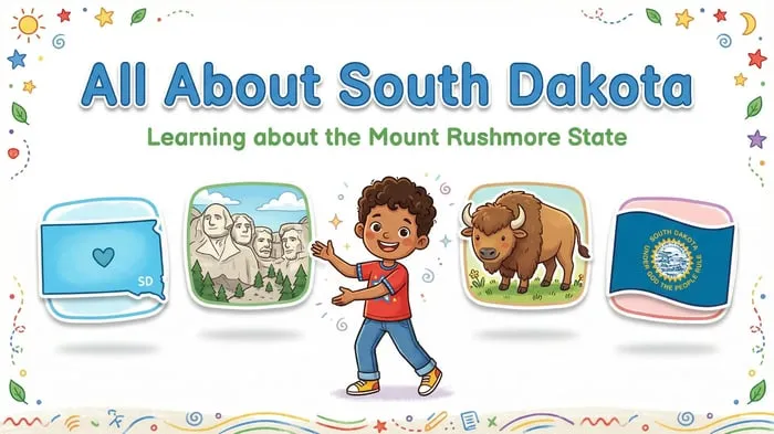
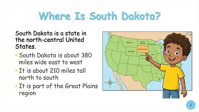
South Dakota State Study: Facts, Symbols, and Famous Landmarks: an “All About South Dakota” slideshow with the state shape, flag, and bison, major cities, the Black Hills spruce, the state economy, a fun fact slide on its 66 counties, and a closing review.
Sources and scope
- SD.gov: the official state website, with general information about South Dakota.
- Mount Rushmore National Memorial, National Park Service: history and facts about the memorial.
- Badlands National Park, National Park Service: information about the park’s geology and wildlife.
- CAST UDL Guidelines: a framework for offering multiple ways to learn and show learning.
This guide covers an introductory elementary unit on South Dakota. It does not cover the full history of the state or of the Lakota and other Native nations of the region, which older students can explore through deeper study.
Key takeaways
- Start South Dakota facts with the map, six neighbors, and the Missouri River.
- Teach a few core facts well before adding more.
- Use Mount Rushmore, the Badlands, and bison as memory anchors.
- Connect symbols and the economy to places on the map.
- Review with a short quiz plus a creative project.






Leave a Comment