

Maine facts for kids can turn a quiet geography block into a lesson students remember for years. Picture a grade 3 class staring at a blank outline of the United States: most children can find their own state, but the top right corner is a mystery. Then someone points at it and asks why a whole state is named after pine trees, and suddenly every hand goes up.
This guide shows you how to turn that curiosity, and a handful of Maine facts for kids, into a short, organized state study. By the end, you will be able to plan five focused lessons, choose facts that are accurate and kid friendly, and check what students actually learned. Examples are fictional. Adapt to the student’s goals and agreed supports. This is guidance, not a diagnosis.
At a glance
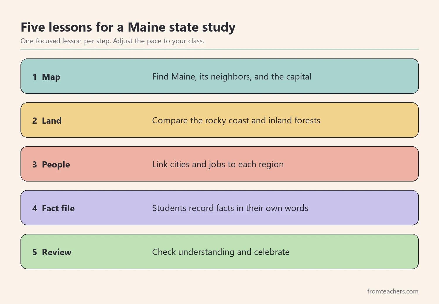
- Start with the map: where Maine sits, what borders it, and where its capital is.
- Teach the land in two parts, the rocky coast and the forested inland.
- Connect facts to people through cities, fishing, forestry, and lighthouses.
- Let students build a small fact file instead of copying a long list.
- Finish with a short review that checks understanding, not just recall.
1. Start Maine facts for kids with the map
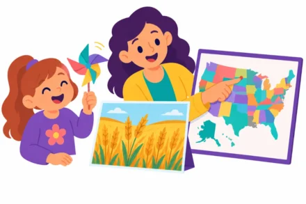
Every state study works better when children know where the place actually is. Maine facts for kids make far more sense once students can point to the state. Before any fun facts, give students a simple outline map of the United States and ask them to find the most northeastern state. That state is Maine.
Next, add three anchor facts that students can see on the map. First, Maine touches only one other U.S. state, New Hampshire, to the west. Second, it shares a long border with Canada to the north and east. Third, its southern and eastern edge runs along the Atlantic Ocean.
After that, mark the capital. Many children guess Portland, because it is the biggest and best-known city. In fact, the capital is Augusta. This small surprise is useful, because it teaches students that the largest city and the capital are not always the same place.
Worked example: Ms. Rivera’s class
Ms. Rivera teaches grade 3. She gives each pair of students a blank map and three colored pencils. Students shade New Hampshire in one color, Canada in a second, and the ocean in a third. Then they draw a star for Augusta.
One student, Leo, places the star on the coast. Instead of correcting him right away, Ms. Rivera asks him to compare his map with the class map. Leo moves the star inland on his own and explains why. That short moment does more than a lecture would.
| Map task | What students mark | Time |
|---|---|---|
| Find Maine | Outline the state | 3 min |
| Neighbors | New Hampshire and Canada | 5 min |
| Water | Atlantic coast | 3 min |
| Capital | Star on Augusta | 4 min |
The four tasks add up to 15 minutes, which leaves room for a short discussion before the lesson ends.
2. Teach the land: coast, forests, and mountains
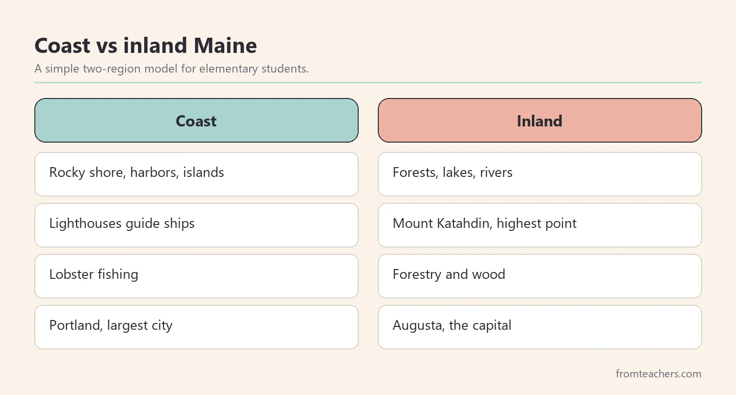
Once students know where Maine is, help them picture what it looks like. Good Maine facts for kids describe a place children can see in their minds. Maine is easiest to teach in two parts. The coast is rocky, full of harbors, islands, and lighthouses. Inland, much of the state is covered in forest, with lakes, rivers, and mountains.
Start with the nickname, the Pine Tree State. Ask students why a state would choose that name. Then show photos of thick forests and let them guess. Forests cover most of Maine, so the nickname fits the land.
Then introduce two landmarks. Mount Katahdin is the highest point in Maine, and it marks the northern end of the Appalachian Trail. Along the coast, Acadia National Park protects mountains, forests, and shoreline on Mount Desert Island and nearby areas. The park’s Cadillac Mountain is known as one of the first places in the United States to see the sunrise for part of the year.
Worked example: sorting land cards
Ms. Rivera prints eight picture cards: a lighthouse, a harbor, a lobster boat, an island, a moose, a pine forest, a lake, and a mountain. Students sort them into two piles, coast and inland. Four cards go in each pile.
Leo puts the moose under coast at first. A classmate points out that moose live mostly in forests and near wetlands. Leo moves it, and the class agrees the inland pile now has four cards: moose, forest, lake, and mountain. Consequently, students leave with a clear mental picture instead of a list of words.
For a ready-made set of slides on this part of the unit, the Maine state study slideshow on Acadia, cities, and culture walks students through the landmarks one fact at a time.
3. Connect Maine facts for kids to people and work
Maine facts for kids about land become more meaningful when students see how people live there. This step links places to jobs, towns, and traditions. It also helps children understand why certain symbols, like lobsters and lighthouses, show up everywhere in Maine pictures.
Begin with cities. Portland is the largest city and sits on the coast. Lewiston and Bangor are other well-known cities. Augusta, as students learned in step 1, is the capital. Keep the city list short so children can actually remember it, since Maine facts for kids should stick, not overwhelm.
Next, talk about work. Fishing has long been important along the coast, and Maine is famous for lobster. Inland, forestry has been a major industry for generations, which connects back to the Pine Tree State nickname. Lighthouses guided ships along the rocky shore, and many still stand today.
Worked example: a job match
Ms. Rivera writes three jobs on the board: lobster fisher, forester, and lighthouse keeper. Students match each job to a region from step 2. Lobster fisher and lighthouse keeper go to the coast. Forester goes inland.
Then each student writes one sentence: “A ____ in Maine works near the ____ because ____.” Leo writes, “A forester in Maine works near the trees because most of the state is forest.” It is simple, but it shows real understanding.
| Job | Region | Link to land |
|---|---|---|
| Lobster fisher | Coast | Ocean and harbors |
| Forester | Inland | Large forests |
| Lighthouse keeper | Coast | Rocky shoreline |
4. Build a Maine facts for kids fact file
By now, students have heard many Maine facts for kids. However, hearing is not the same as remembering. A fact file gives each child a small, organized record they build themselves. It works better than copying a long list from the board.
Keep the file to five or six categories. Each category gets one fact, one picture, and one sentence in the student’s own words. Short entries keep the focus on understanding, and they are easier to review later.
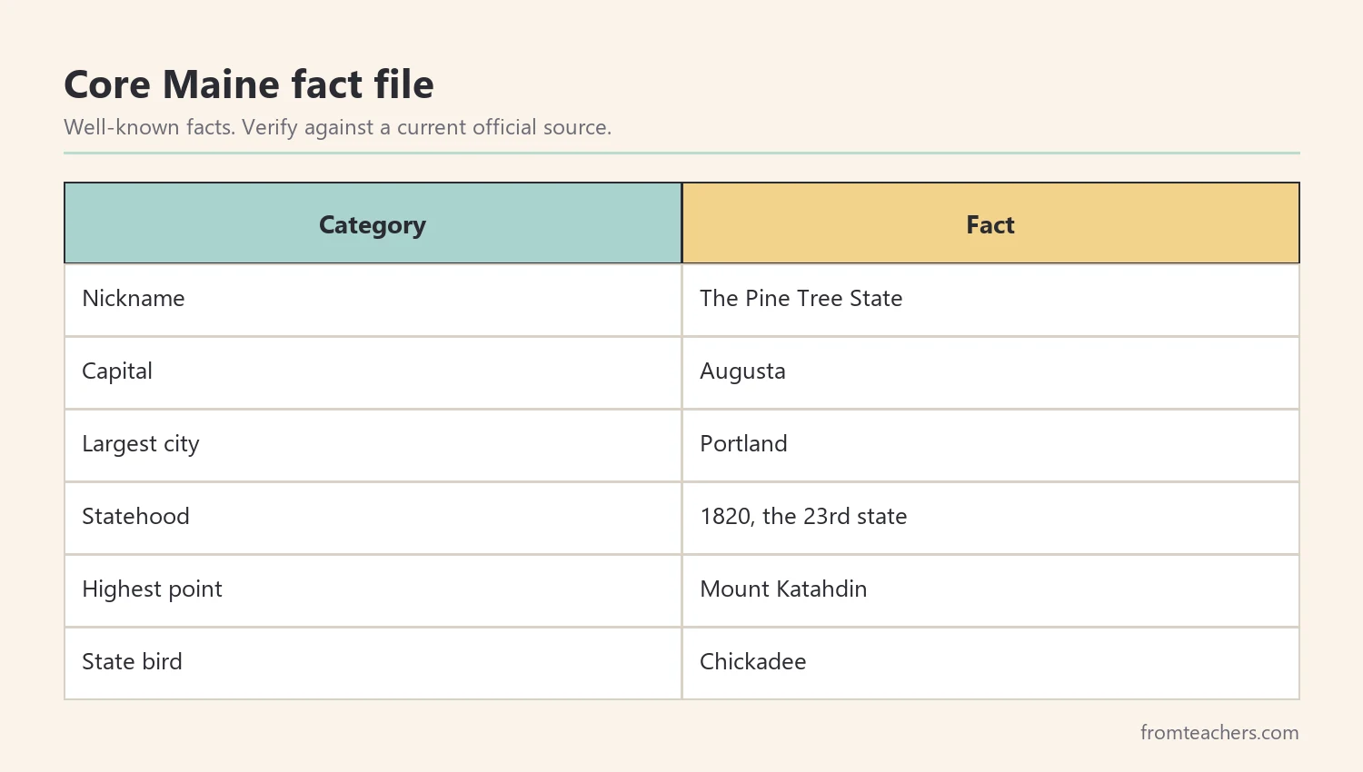
Here are categories that work well for elementary students. The nickname is the Pine Tree State. The capital is Augusta. The largest city is Portland. Maine became the 23rd state in 1820. The highest point is Mount Katahdin. The state bird is the chickadee.
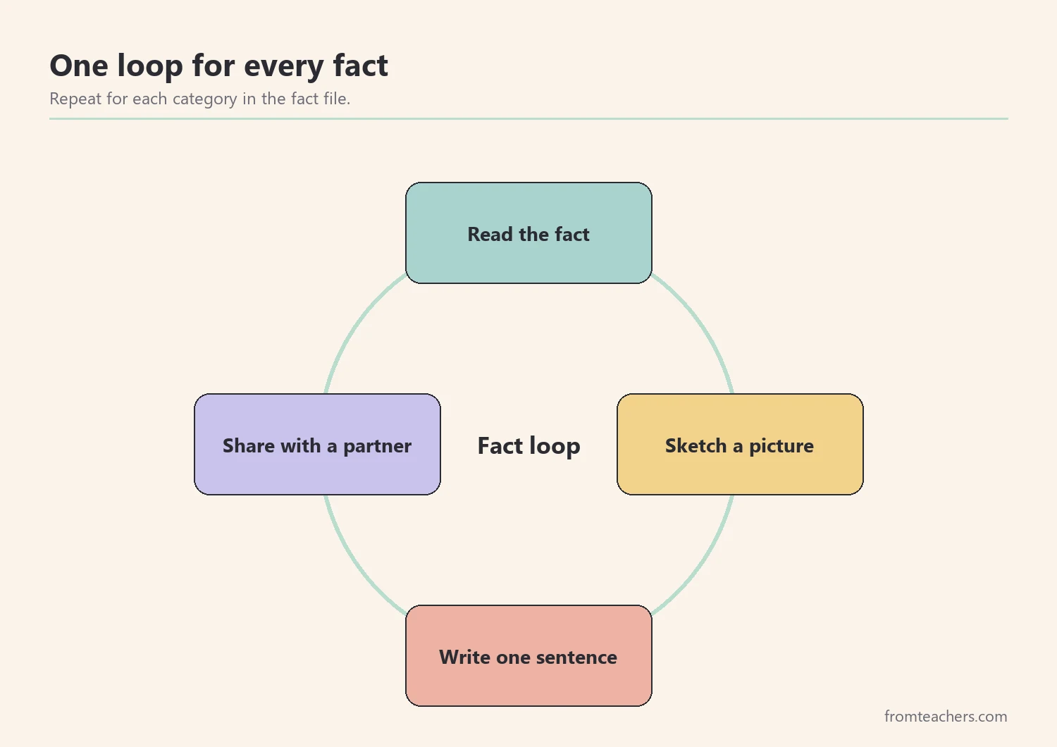
Before students write anything, model one entry aloud. Show how you read a fact, sketch a quick picture, and write a sentence that explains it. Then let students complete the rest in pairs.
Worked example: Leo’s fact file
Leo chooses six categories. For “Statehood,” he draws a birthday cake with 1820 on it and writes, “Maine became a state in 1820, and it was number 23.” For “Highest point,” he draws a mountain with a hiker and writes, “Mount Katahdin is the top of Maine and the end of a long trail.”
Ms. Rivera checks one entry per student, not all six. She looks for accuracy and a sentence in the child’s own words. Therefore, the check takes only a few minutes for the whole class.
Extension ideas for fast finishers
Some students will finish their fact file early. Rather than handing them more of the same, give them a choice of small extensions that stretch the same Maine facts for kids in a new direction.
- Write a postcard from Acadia describing what a visitor might see at sunrise.
- Draw a simple lighthouse and label three parts that help ships at night.
- Compare Maine with your own state using two facts from each.
- Plan a pretend road trip from Portland to Augusta and list what you might pass.
Each extension uses facts students already learned, so nobody has to research new material alone. In addition, the finished work makes a good display for the review lesson. Families also enjoy seeing a postcard or a drawing come home, and it gives parents an easy way to ask about the unit.
5. Review and celebrate what students learned
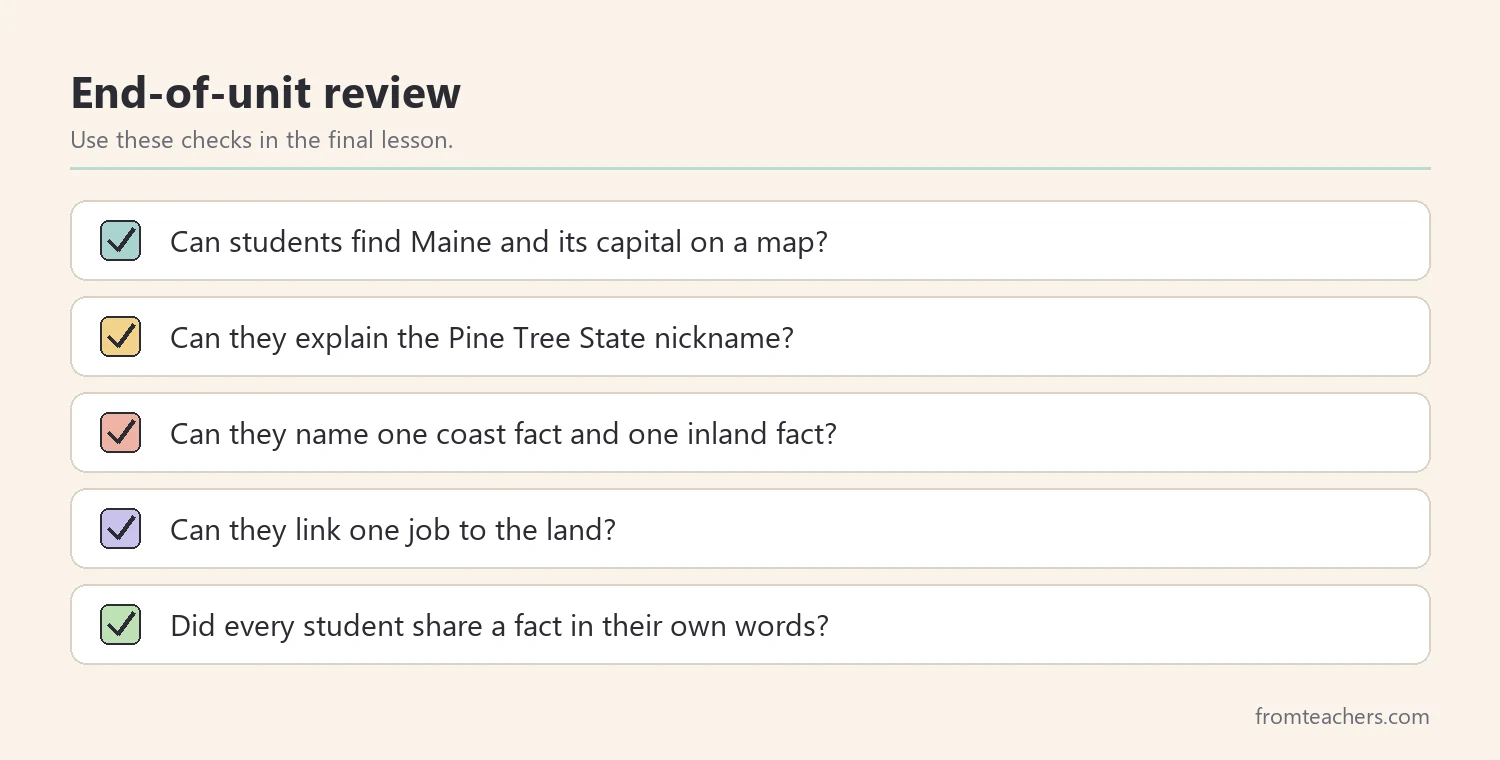
The last lesson pulls all the Maine facts for kids together. A good review checks whether students can explain facts, not just repeat them. It also gives the unit a clear, happy ending.
Start with a quick quiz of five questions about the Maine facts for kids you taught. Mix recall questions with “why” questions. For example, ask “What is the capital of Maine?” and also “Why is Maine called the Pine Tree State?” The second question shows whether students connected the nickname to the land.
Next, let students share one favorite fact from their file with a partner. Partners must ask one follow-up question. This builds speaking skills and catches misunderstandings early.
Worked example: the class review
Ms. Rivera has 24 students. She splits them into 6 groups of 4. Each group gets one region card, coast or inland, and must name two facts, one place, and one job from that region. Three groups get coast and three get inland.
Leo’s group gets inland. They name Mount Katahdin, the forests, Augusta, and foresters. The class then votes on a “Maine poster” made from all six group answers. As a result, every student sees how the pieces fit together.
Ideas for a closing celebration
Finally, celebrate. A short closing slide, a class poster, or a “postcard from Maine” writing task gives children a sense of finishing something real. Celebrations also help families hear about the unit at home.
Common mistakes and how to avoid them
- Teaching too many Maine facts for kids at once. Fix: choose five or six core facts and repeat them across lessons.
- Skipping the map. Fix: always start with location, borders, and the capital so later facts have a place to land.
- Using outdated numbers. Fix: check populations and other figures against a current official source before teaching them.
- Treating symbols as trivia. Fix: connect each symbol, like the pine tree or the lobster, to the land or the work behind it.
- Only testing recall. Fix: add at least two “why” questions to every review.
Questions teachers and parents ask about Maine facts for kids
What grade level fits Maine facts for kids?
Most state studies, including Maine facts for kids, happen in grades 2 to 5. Younger students can focus on the map, the nickname, and a few pictures. Older students can add statehood, industries, and short research questions.
How long should a Maine unit take?
Five short lessons of 30 to 45 minutes work well for most classes. You can stretch the unit with a research project or shorten it to three lessons if time is tight.
Is it true that Cadillac Mountain sees the first sunrise in the country?
Cadillac Mountain is known as one of the first places in the United States to see the sunrise, but only during part of the year. The exact first spot changes with the seasons. Share it as an interesting fact with that small detail included.
How can parents use Maine facts for kids at home?
Parents can look at a map together, find Maine, and talk about the coast and forests. A simple “three Maine facts for kids at dinner” game works well. Library books and park websites add photos and stories.
How do I adapt this unit for students who need extra support?
Use picture cards, fewer categories, and sentence starters. Let students point, sort, or draw instead of writing. Keep the same core Maine facts for kids so every child joins the class review.
Related reading: Learning Styles Student Success Guide and 5 Practical Teaching Tips to Boost Classroom Focus and Learning.
A companion resource for Maine facts for kids:
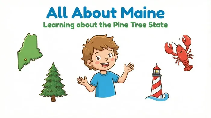
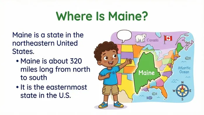
Maine State Study: Facts, Culture, and Famous Landmarks: a 30-slide illustrated resource covering major cities, Acadia National Park, fishing and forestry culture, and lighthouses, with a review of key facts and a celebratory closing slide.
Sources and scope
- Maine.gov: the official state government website, useful for checking state symbols and basic facts.
- National Park Service: Acadia National Park: official park information, photos, and visitor details.
- National Council for the Social Studies: guidance and resources for teaching social studies and geography.
- Library of Congress: historical maps, photos, and primary sources about the states.
This guide covers planning an elementary Maine state study with core geography, landmarks, and culture. It does not replace current official data, so check numbers like populations before you teach them.
Key takeaways
- Teach Maine facts for kids starting with the map, borders, and capital.
- Split the land into coast and inland so students can picture it.
- Link facts to people through cities, fishing, forestry, and lighthouses.
- Have students build a short fact file in their own words.
- Review with “why” questions and end the unit with a celebration.



Leave a Comment